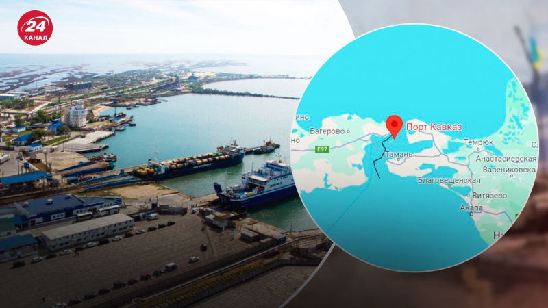
UAVs attacked a ferry in the Krasnodar region: we show on the map where the Caucasus port is located Polina Buyanova Drones hit the port “Caucasus”/Collage 24 Channel On the night of July 23, drones attacked the Russian port “Kavkaz” in the Krasnodar region. It is reported that a ferry ship was under attack. According to the Governor of the Krasnodar Territory Veniamin Kondratiev, a ship caught fire in the port, allegedly among the crew members and there are injured and dead employees. Eyewitnesses reported that after the attack, ambulances and firefighters were driving towards the Kavkaz port. This morning, drones attacked the ferry ship in the port “Kavkaz”. Emergency services are currently on the scene. The fire is local, there is no threat of the fire spreading, said a Russian official. It is interesting that, according to the Crimean Wind channel, messages about the “arrival” in port. According to the Russians, the port of Kavkaz is the fifth largest port in Russia in terms of cargo turnover and the second in terms of cargo turnover in the Black Sea-Azov basin after the port of Novorossiysk. It is located on the Chushka Spit in the Kerch Strait. On the territory of the port there is a car ferry that connects the Krasnodar region with the temporarily occupied Crimea. Where the Russian port “Caucasus” is located: we show it on the map The port itself is located 5 kilometers from Crimea and 10 kilometers from the Crimean Bridge. By the way, on the night of July 22, the aggressor country was also attacked by drones. In particular, they hit the oil refinery in Tuapse twice.
Drones hit the port “Caucasus”
UAVs attacked a ferry in the Krasnodar region: we show on the map where the port “Caucasus” is located
69

