The first satellite images after the attack on the Container radar in Mordovia/Collage 24 Channel Recently, drones attacked a Russian military facility in Mordovia, where an over-the-horizon radar station under the designation 29B6 “Container” operates. The first satellite images after the defeat were published online. Recall that on April 17, Ukrainian drones attacked a military facility on the territory of Mordovia. The target was the 29B6 “Container” over-the-horizon radar, which is part of Russia's missile defense system. OSINT analysts have released satellite images showing a 200-meter stretch of scorched earth near the antenna of the Russian 29B6 “Container” radar in Mordovia, which was attacked on April 17. < /p> OSINTtechnical posted this on its X (formerly Twitter) page on Friday, April 19th. As can be seen at Images taken on the afternoon of April 19 show a large area of scorched earth in the area of the 590th separate radio engineering center of military unit 84680 in Russian Kovylkino (Mordovia). OSINT analysts noted , that the “Container” is intended to provide “long-range airspace monitoring and ballistic missile detection.”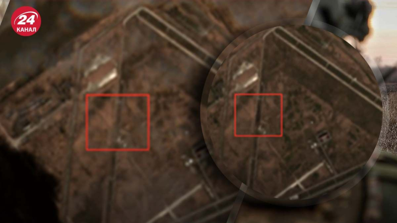
Consequences of an attack on the “Container” radar in Mordovia
Details about the defeat of the radar “Container”
Scorched earth: the first satellite images after the defeat of the Container radar in Mordovia

73