
The full-scale war in Ukraine began at around 05:00 on February 24, 2022, by order of Russian President Vladimir Putin.
The invasion began with an attack on airfields, military warehouses in Kyiv, Kharkov and Dnepr, as well as on the state border in the area with Russia, Belarus and occupied Crimea.
ICTV Facts offers combat maps from Deep State, Institute for the study of war and CTP, which conditionally display the situation in Ukrainian cities. Also available is a combat map liveuamap.com.
Now watching
Map of military operations in Ukraine Deep State online
Legend on the map:
- blue areas – territory from which the occupiers have been driven out;
- green areas – territory cleared at the end of March – beginning of April;
- grey areas – territory requiring clarification;
- red areas – territory captured by occupiers;
- black color – the territory of Crimea and ORDLO;
- pink color – territory of Transnistria.
The Deep State map also shows enemy units, headquarters, airfields, fleets and attack directions of the occupiers.
Never use the map to plot safe routes, use the green corridors provided by the authorities.
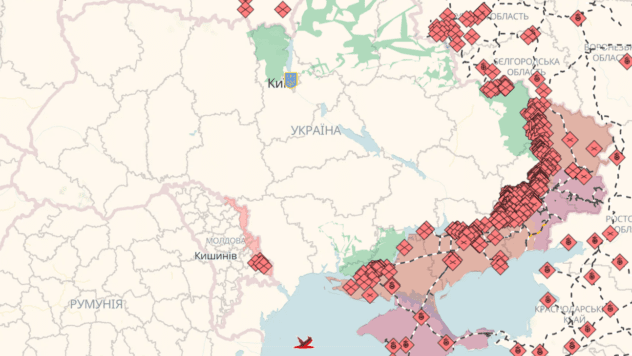
Map of military actions liveuamap.com
On the map you can see online where the battles are taking place in Ukraine, which territories are already free from the occupiers and other important events.
Color legend on the map:
- blue – the Ukrainian government, NATO, other Western forces;
- red – Russia, Belarus, Transnistria.
The areas on the map marked in red are temporarily occupied territories of Ukraine.