In Guevo, Kursk region, the Ukrainian flag was raised: where is the village on the map and what is the distance to the border Dmitry Usik Flag of Ukraine in Guevo/Collage 24 Channel On Sunday, August 11, a video appeared online showing a Ukrainian flag being hung instead of the tricolor in the village of Guevo in the Kursk region. Russians are complaining that the village has come under the control of the Ukrainian Armed Forces. The village of Guevo is located directly on the border with Ukraine. Where exactly, Channel 24 shows. Fighting has been going on in the Kursk region for 6 days in a row. Thus, on August 11, a video was shown online showing soldiers removing the Russian tricolor in the village of Guevo, replacing it with the Ukrainian flag. Note that Guevo is a populated area in the Sudzhansky district of the Kursk region. The village is located 3.5 kilometers from the Russian-Ukrainian border, 96 kilometers southwest of Kursk, 10.5 kilometers south of the district center – the city of Sudzha. Where is the village of Guevo located: see the map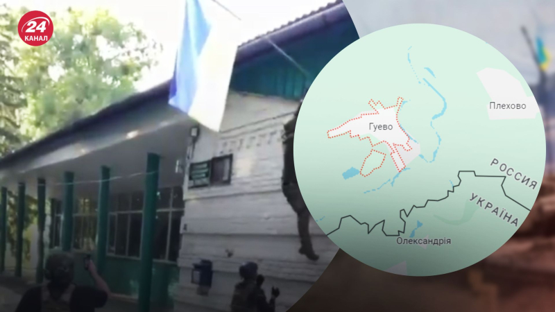
Ukrainian flag in Guevo
In Guevo, Kursk region, the Ukrainian flag was raised: where is the village on the map and what is the distance to the border

75