Dam break in the Chelyabinsk region: we show on the map where it happened Anastasia Kolesnikova In the Chelyabinsk region, a dam broke and flooded villages/Collage 24 Channel One of the Russian regions was covered by flooding. Residents of the Chelyabinsk region are fleeing the water on the roofs of their own houses. It is noted that the breakthrough occurred at the Kialim reservoir. Due to the high water level, 100 meters of the dam were destroyed, as a result of which several nearby villages were flooded. The reservoir is located near the city of Karabash – only 8 kilometers away. The length of its dam is 545 meters. It was created in 1979 at the confluence of the Indishta River and the Bolshoy Kialim River. The height above sea level is 270 meters. Where is the Kialim reservoir: see the map Recall that the dam burst on the evening of July 26. Local authorities called on residents of five flooded villages to prepare for evacuation. These are Kiolim, Mukhametovo, Karasayevo, Baydashevo and Saktayevo. In the urban district itself (Karabakh), water supply may be cut off. There are about 200 people in the flooded area.
Where did the dam break in Russia/Screenshot Russian media write that water poured through the top of the dam locks on the Kialim reservoir during the day. Residents say that they warned local authorities about a possible breakthrough, but no one listened to them. The flooding was facilitated by a Caspian cyclone, which flooded the region for several days. Now a state of emergency has been declared in the Karabakh region, buses are being prepared for evacuation.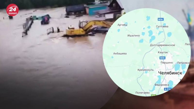
Where did the dam break in the Chelyabinsk region
Dam break in Chelyabinsk region: we show on the map where it happened

70