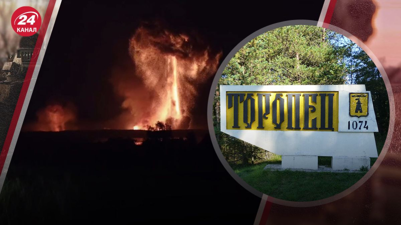
Another powerful blow to the Russian arsenal near Toropets: where the city is located on the map Angelika Baibak Ammunition depot hit in Toropets/Collage 24 Channel On the night of September 18, powerful explosions thundered in the city of Toropets in the Tver region. According to preliminary information, drones hit a warehouse with ammunition, large-scale fires broke out. Moreover, the blast wave from the detonation was so powerful that the Russian authorities announced an evacuation. Where on the map is the city of Toropets in the Tver region – shows 24 Channel. On the night of September 18, powerful explosions thundered in the city of Toropets in the Tver region. Spectacular footage of the explosions was published online, and local residents claimed that they had allegedly hit a military unit and an ammunition depot. Following powerful explosions and large-scale fires, the Toropets District Administration has issued instructions for local residents who must urgently evacuate from the site of a serious fire in the city of Toropets. According to local authorities, there are evacuation buses at the city's Market Square. The vehicles will move along the M9 highway toward the city of Zapadnaya Dvina. People will likely be accommodated in temporary centers there. Toropets is the westernmost city in the Tver Region and the most remote district center from Tver. Much closer to Toropets than Tver are other regional centers – Veliky Novgorod, Smolensk and Vitebsk. Russian city of Toropets on the map As they write in open sources, this is one of the oldest cities in this Russian region, because there are mentions of it allegedly since 1074. It is known that in addition to cultural monuments, the city also has military units No. 71628 and No. 54169. The city of Toropets is also located about 480 kilometers from the border with Ukraine. How far is Toropets from Ukraine/Screenshot You can also see huge warehouses on the map. As some Telegram channels write, the 107th arsenal of the Main Missile and Artillery Directorate of Russia is located in this place. Warehouses near Toropets/Screenshot Explosions and a large-scale fire are still ongoing. Evacuations have also been announced in other settlements of the Toropets District. On the night of September 21, explosions thundered again in the Tver Region of Russia, in particular in Toropets. Drones attacked the arsenal of the Main Missile and Artillery Directorate of the Russian Ministry of Defense in the village of Oktyabrskoye. As a result of the drone attack, a fire broke out and the ammunition began to detonate, the fragments of which flew in different directions. The fire was visible even from Toropets, which is 16 kilometers from Oktyabrsky. Tver Region Governor Igor Rudenya reported that the attack was allegedly successfully repelled. The ammunition depot in Oktyabrsky is the 23rd arsenal of the GRAU, occupying an area of 2.6 square kilometers.
Russian city of Toropets on the map
What is known about the repeated explosions near Toropets
Another powerful blow to the Russian arsenal near Toropets: where is the city located on the map
62

