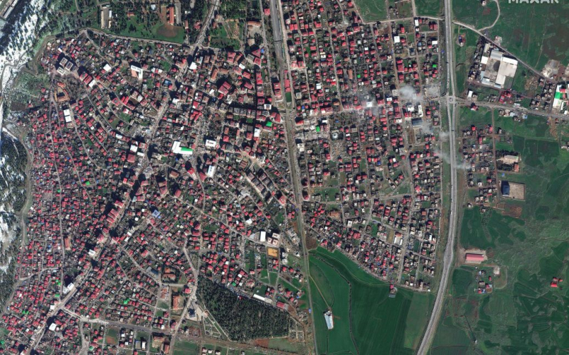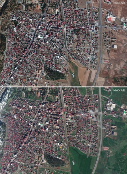
Significant destruction can be seen in the images taken after the earthquake in the city of Islahie.
Maxar Technologies has published satellite images of the Turkish city of Islahia, taken before the earthquake, and one day after the disaster.
This was reported on the Maxar Technologies website.
First photos of the city made on October 4, 2022, and the next ones on February 7, 2023. In the last pictures you can see significant destruction of houses.

“Our latest images of the earthquake in Turkey. Weather and cloud cover have affected new images of the affected areas,” the company said.
To activate our Open Data Program (https://t.co/KG4Ln7Gvck) for powerful #earthquakes in #Turkey and #Syria. Please stay tuned for that notification. There is also another after (Oct 4, 2022) and after (Feb 7, 2023) view of #Islakhiev, Turkey and destruction. pic.twitter.com/jd8KakGRgb
— Maxar Technologies (@Maxar) February 7, 2023
We working with several organizations to provide them with a #satellitepicture of contemporary earthquakes that have been removed by #Turkey & #syria. Only here (after 4, 2022) and after (Feb 7, 2023) images from #Islahiye, Turkey, showing collapsed buildings & rescue operations. pic.twitter.com/3c69oZFYmu
— Maxar Technologies (@Maxar) February 7, 2023
Recall that a devastating earthquake of magnitude 7.8 occurred in Turkey on February 6 near the city of Gaziantep. It has already claimed the lives of more than 4.5 thousand people. Over 26,000 more were injured.
The 10 provinces affected by the powerful earthquake will be declared a state of emergency for 3 months.

