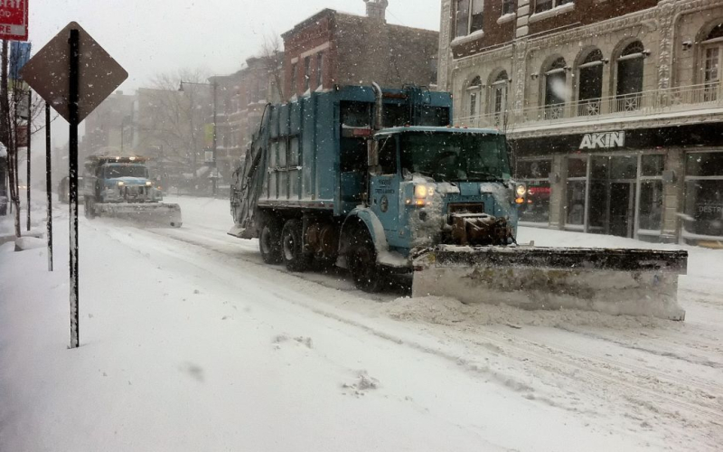
From Missouri to Philadelphia, millions of people will be under threat from a winter storm that will bring strong winds and hazardous travel conditions.
A powerful winter storm in the United States is expected to affect 62 million people, bringing heavy snow, dangerous ice, rain and thunderstorms to an area spanning 1,300 miles people.
CNN reports on this.
Snow and ice have been limited to the northern states in the east this winter, but this storm will push those boundaries and bring dangerous conditions to many people from the Plains to the East Coast, including regions less prone to winter weather.
This powerful weather system will hit at least twelve states, combining snow, ice, and blizzard conditions with wind gusts up to 40 mph (64 km/h), creating hazardous travel conditions and potential power outages across a large region.
“For some, this could be the heaviest snowfall in a decade,” the Weather Prediction Center warned NOAA.
The storm could bring severe thunderstorms to areas where temperatures are too warm for snow and ice, including areas still recovering from the deadly December storms.
The storm is expected to continue through Sunday in parts of the central United States and will have a major impact on daily life, including “significant disruption, dangerous or impossible driving conditions, and general road closures,” according to the Winter Storm Severity Index.
The storm will begin Saturday afternoon and will be driven by a strong stream of moist air moving north from the Gulf of Mexico.
It will then move east, spreading winter chaos across the Mississippi Valley and parts of the Midwest through Sunday morning. The storm will move into the Ohio Valley and the Southeast Sunday before reaching the East Coast overnight Sunday and Monday.
The greatest risk to local areas is probably clear, but determining exactly where snow, ice, or mostly rain will fall — and how much — is still very difficult. Small changes in a storm’s path can completely change the forecast. Some areas may start out as snow but turn to a warming icy mix, while other areas may see rain or icy mix gradually turn to snow.
This storm could dump over a foot of snow and ice, causing power outages just as temperatures are reaching their lowest point this season.
The storm will dump several inches of snow Saturday night, spreading into the Ohio Valley Sunday, and then into the Mid-Atlantic Sunday night into Monday, making commutes in places like Washington, D.C. and Philadelphia quite dangerous Monday.
More snow will fall in the coldest areas, likely in parts of Missouri, Illinois, Indiana, Ohio and West Virginia. Snow amounts will be lighter in areas where warmer air causes sleet and ice instead of snow.
St. Louis has only had four days where more than a foot of snow fell in a day, and that could happen Sunday. Snow totals could range from an inch to more than a foot in parts of Missouri, depending on the storm's track. This variable forecast also extends to neighboring states, where some areas could see snowfalls approach January record levels.
Kansas City could break its January record of 7 inches set in 2011, while Indianapolis could also break its record of 11 inches set in 2014.
Kansas City International Airport closed its airport for more than two hours Saturday afternoon due to “imminent icing,” according to a report on X.
Parts of the Kansas City metropolitan area have seen “freezing drizzle” “beginning to coat surfaces with ice cork.”
Despite other storm conditions this winter, Minnesota, Wisconsin, Michigan, and northern New York may see little or no snow due to the storm's more southerly track.
Dangerous ice is more threatening to areas south of the snow regions. Significant icing is possible in Kansas, Missouri, central Appalachia, and possibly parts of Maryland and Delaware.
Several state governors have already declared states of emergency.
Recall that forecasters warned of colder weather in Ukraine on January 5, with cloudy skies and icy roads. However, warming is expected in a few days.
Read also:
Related topics:
More news

