
Satellite images of the American space technology company Maxar Technologies show how the Irpin River was flooded due to a dam explosion.
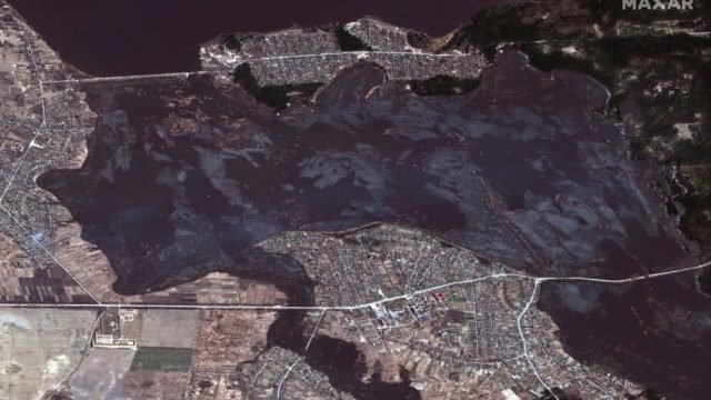
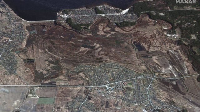

Satellite images showed the flood of the Irpen River/2 photos
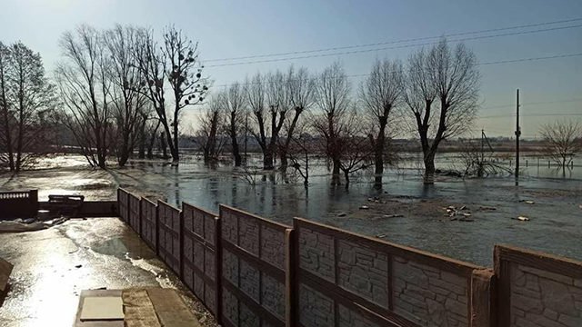
In the photo you can trace the flood zone near the village of Kozarovichi, Kiev region.
Water reaches the village of Demidovo, in the Vyshgorodsky district .
A few days earlier, the Kiev Regional Council warned that the water level in the Irpin River had already reached the maximum allowable level, and its further growth would cause flooding of roads and basements in the village.
It happened because the Irpen River is below the level The Kiev Reservoir was supplied there by pumps before the explosion.
Back in late February, the General Staff of the Armed Forces of Ukraine announced the plans of Russian troops to resume the offensive against Kyiv through Polissya using a pontoon crossing near Demidov across the Irpin River.
After the invaders blew up the pumping station in Kozarovichi, where the Irpen River flows into the Kiev reservoir, the Office of the Prosecutor General opened proceedings on the fact of violation of the laws and customs of war.
According to the Criminal Code, this act is punishable imprisonment for up to 12 years.
Full-scale war in Ukraine has been going on for 29 days already.
You can follow the situation on the interactive map of hostilities in Ukraine.
For more information about the war in Ukraine – read the online news in the ICTV Facts article.