
Russians in a panic after the latest attacks on the illegal Crimean bridge have been installed near the construction of a barge to protect against Ukrainian sea drones.
Russia, most likely, did not completely flood the barges near the Crimean bridge, but only anchored them in one place.
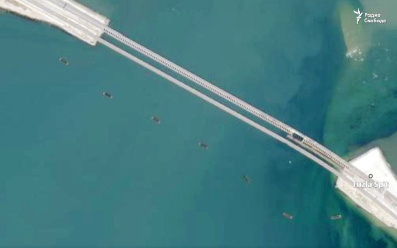
This is reported by Radio Liberty, which received satellite images of the service Planet.com.
The photo shows that barges have been set up south of the illegal Crimean bridge. They were probably partially flooded, because the depth in this place does not exceed 2-4 meters.

Perhaps these barges are Russians they plan to use it as a basis for protecting the bridge from Ukrainian sea drones.
Recall that earlier the GUR reported that Russian invaders were flooding ferries in the area of the Kerch Strait to protect the illegal Crimean bridge. According to the plan of the occupiers, at least six vessels are to be sunk in order to create barriers against Ukrainian sea drones.
Subsequently, satellite photos appeared on the Web near the Krymsky bridge, which show improvised Russian water barriers on the western approaches to the Kerch crossing .
Related topics:
More news