
Work on 3D-shooting of historical monuments started thanks to a trilateral agreement between the Dagestan State University (DSU), the Geoscan group of companies producing unmanned aerial vehicles and the Qatar-Russian Cooperation Center (QRCC).
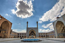
The goal of the joint project is to create three-dimensional models for the subsequent study of the architectural heritage of Dagestan. Digital copies will also help professionals, including professors and scientists from the University of Qatar, in the restoration of monuments. In addition, decaying cultural objects will be preserved for posterity. 3D models will appear at Kala-Koreysha, Derbent Juma Mosque, Datun Temple and other architectural objects of Dagestan.
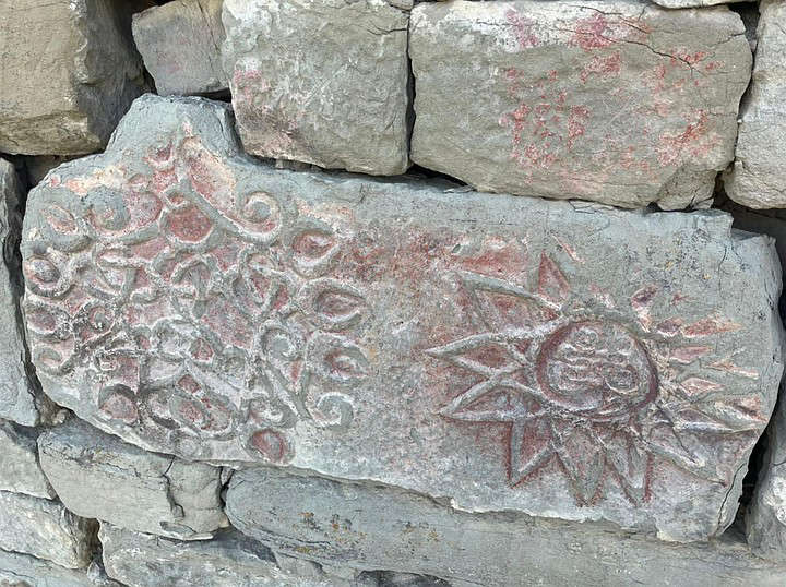
The North Caucasian republic has a rich historical heritage of Muslim culture and Arabic writing, therefore, among the main tasks of cooperation is not only the study of cultural objects of Dagestan, but also their popularization in Arab countries. The project will help unite Arabists from all over the world for the study of historical monuments and the development of scientific international cooperation. So, already this year, scientists from Hamad bin Khalifa University (Qatar) are planning their first research trip to Dagestan to get acquainted with the monuments and continue scientific cooperation.
To create virtual twins, ground and aerial photography by the Gemini unmanned complex is used. A camera mounted on a maneuverable drone with a maximum resolution of 20.1 megapixels takes high quality photos: the detail is usually 3 cm / pixel.
This time, the shooting takes place at ultra-low altitudes (up to 100 m), and the resulting image resolution will be 1 cm / pixel, which will allow the smallest details to be conveyed as accurately as possible. Subsequently, the entire data set will be processed by Agisoft Metashape – software developed by Geoscan specifically for creating highly detailed 3D models from images.